 After waving our last good-bye to the Carter family, we began a scramble to launch our 6 rafts, 1 catamaran and 3 kayaks. We were a small group trying to launch among huge commercial outfits. What a zoo it was!
It took awhile, as always, to begin to appreciate where we were, why we were doing this, and to look forward to the adventures awaiting us in the next few days.

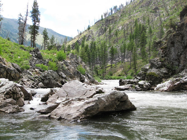
 This "River of No Return" is considered the premier river of the Northwest by rafters. Where we launched, the Middle Fork is little more than a creek. The rocky bottom is barely below the rafts, which explains the many hang-ups on rocks we had among our group. I guess we were never technically stuck, since we always managed to get off the rocks, although some delays were longer than others. The other issue became broken oar blades--we had 3 blades break in the first 3 days. That led to anxiety about running out of spare oars. Fortunately, no more broke.
Over the next 100 miles, the river drops 3000 feet, which makes it a white water marvel. Many creeks flow in, increasing the waterflow and depth as you travel downstream.
(As you'll notice in the photos, this river has suffered severe forest fires over the last few years.)


Most of us growing up in the area are aware of the Lewis and Clark Expedition traveling along the Salmon River with their interpreter, Sacagawea. But thousands of years before Lewis and Clark, the area was inhabited by Sheepeaters, as neighboring tribes called them. I believe a person could still survive on the Middle Fork by eating sheep, judging by the many we saw on our trip.

Mike and I have been interested in petroglyphs and pictographs for the past 40 years. We've traveled to some interesting places in the NW in search of this rock art/language. On the Middle Fork, we were treated to some of the most vivid and definite pictographs we've ever seen. In the large photo, the hand is pointing to a man on a horse, making that image not more than 200 or 300 years old.


The scale of this canyon is phenominal. Some of the photos from the river really show the size of the cliffs.
Getting up above to look down emphasized just how deep and narrow the canyon is.

Before leaving on this raft trip, we questioned whether our granddaughter Angelica was old enough for this trip. Not having been on this river before, we didn't know just how tough the rapids might be. But Angelica is a pretty good swimmer and has been on several other raft trips including the main stem of the Salmon. In the end, she hopped on a raft and away we went.


